the Met Office have issued a rare, severe red weather warning for Storm Eunice in the UK for Friday 18 February.
Storm Eunice is set to bring strong winds of up to 100mph and sustained disruption throughout the country on Friday. This follows Storm Dudley hitting areas across the UK including north Wales and West Yorkshire on Wednesday 16 February with winds of over 80mph.
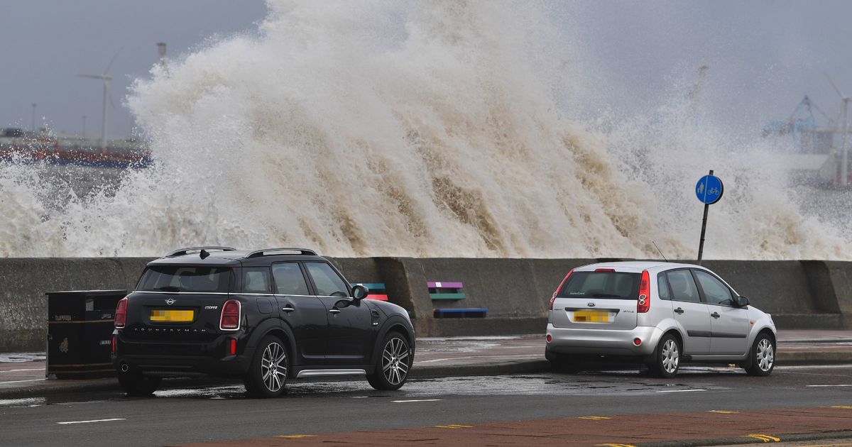
Storm Eunice is predicted to hit the UK and Ireland in the early hours of Friday morning and may cause flying debris, power lines to be struck down and building roofs to fly off.
When was the last red weather warning?
The last red weather warning happened at the time of Storm Arwen in November 2021.
But the last red weather warning for wind alone was back in March 2018 for the snow from Storm Emma.
Storm Arwen brought disruption to coastal areas in the north east of England and Scotland with winds higher than 80mph. The red warning was put in place to ensure people are kept out of harms way of the waves and debris that would cost a danger to life by the coast.
Where are the red weather warnings and where is South West England?
The red weather warning for Storm Eunice has been issued for the south west of England and south Wales for between the hours of 7am and 12 at noon on Friday.
This morning, on Thursday 17 February, the Met Office tweeted: “Rare Red Weather Warning Issued”.
Storm Eunice is expected to travel eastwards across central UK, moving from South Wales to the south west coast of England with winds of 90mph in Cornwall and surrounding areas. These strong wind gusts create a risk to life due to flying objects, falling trees and buildings, and lack of control outside.
An amber warning has been placed on areas across the south of England and the Midlands with 60 to 70mph gusts of wind and some wind and snow in the yellow weather warnings in the north of Englands.
South West England includes areas such as Cornwall and Devon, and all the coastal areas along the line of the Bristol and English Channel.
When does a storm become a hurricane?
At the speed of 74mph, storms can be classified as a hurricane, according to the National Ocean Service in the US and NASA.
Hurricanes are more likely to occur in the United States than in the UK. They are known as large swirling storms.
Storms with maximum consistent winds of 39mph or higher are called tropical storms, or cyclones. Once these maximum sustained winds reach 74mph or higher, the tropical cyclone then becomes a hurricane.
Warm ocean water is also required for a storm to morph into a hurricane. The warm water provides the energy the storm needs to become a hurricane.
Hurricanes start off as tropical disturbances which is when rain clouds are building over an area of warm water until it becomes a tropical depression, being an area of rotating thunderstorms with winds of 38mph. A tropical storm is born once the winds get to 39mph and the final stage before dissipating is the hurricane from 74mph winds.